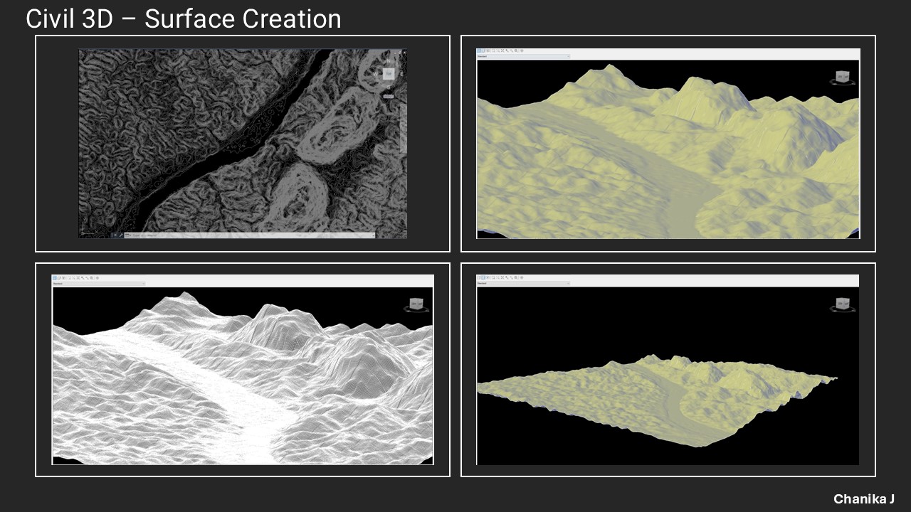
Surface Creation for DEM
In this project, I generated accurate Digital Elevation Models (DEMs) using survey data. Civil 3D was used for terrain modeling and surface analysis to support hydropower and infrastructure projects.
Key tasks included:
- Importing survey and drone point data
- Creating TIN surfaces and contour maps
- 3D modeling for design visualization