Remote Sensing with GEE – NDWI Extraction (Water Surface Mapping)
This project demonstrates the use of Google Earth Engine (GEE) for extracting water surfaces by computing the Normalized Difference Water Index (NDWI) from Sentinel-2 imagery.
NDWI is an effective spectral index for mapping open water bodies, distinguishing them from surrounding vegetation and built-up areas.
🛠 Tools & Data Used
- Platform: Google Earth Engine (JavaScript API)
- Satellite Data: Sentinel-2 Surface Reflectance (S2_SR)
- Study Area: Defined Region of Interest (ROI)
📌 Processing Steps
Step 1: Load Sentinel-2 Imagery
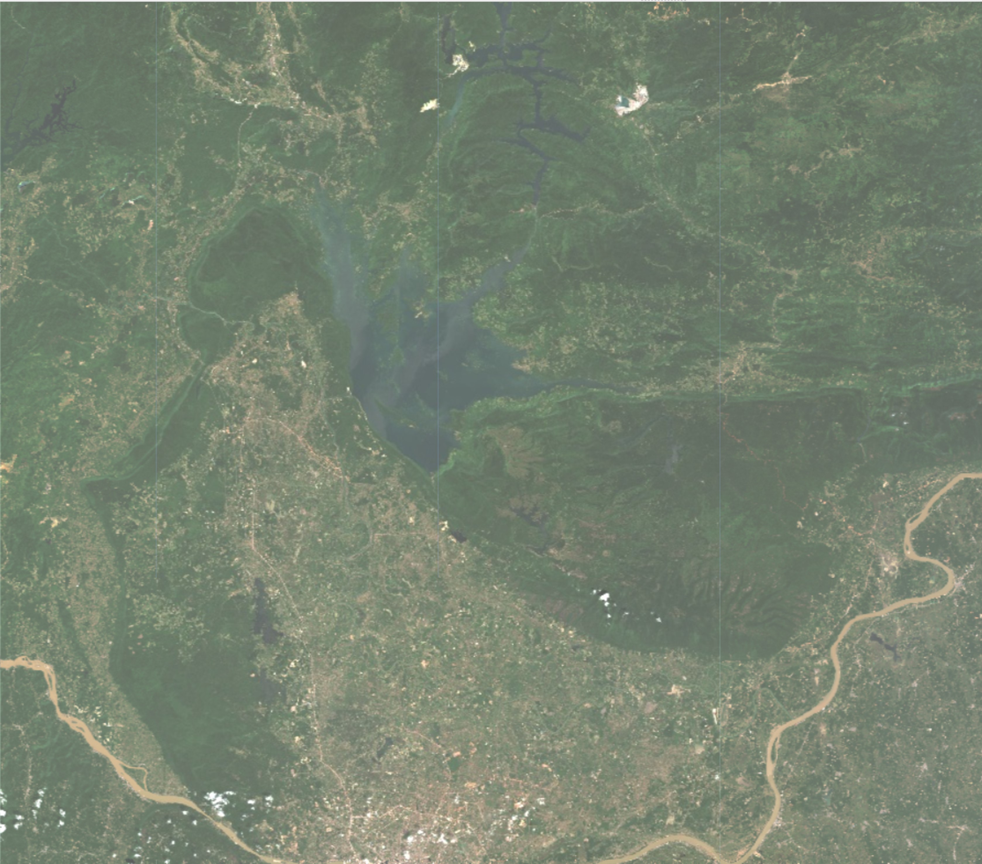
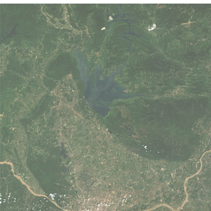
Sentinel-2 surface reflectance data (COPERNICUS/S2_SR) was filtered by region of interest (ROI), time period,
and cloud cover.
var roi = Roi;
var sentinel_Wet = ee.ImageCollection('COPERNICUS/S2_SR')
  .filterDate('2022-06-01','2022-10-30')
  .filter(ee.Filter.lt('CLOUDY_PIXEL_PERCENTAGE', 10))
  .filterBounds(roi);
Step 2: Compute NDWI
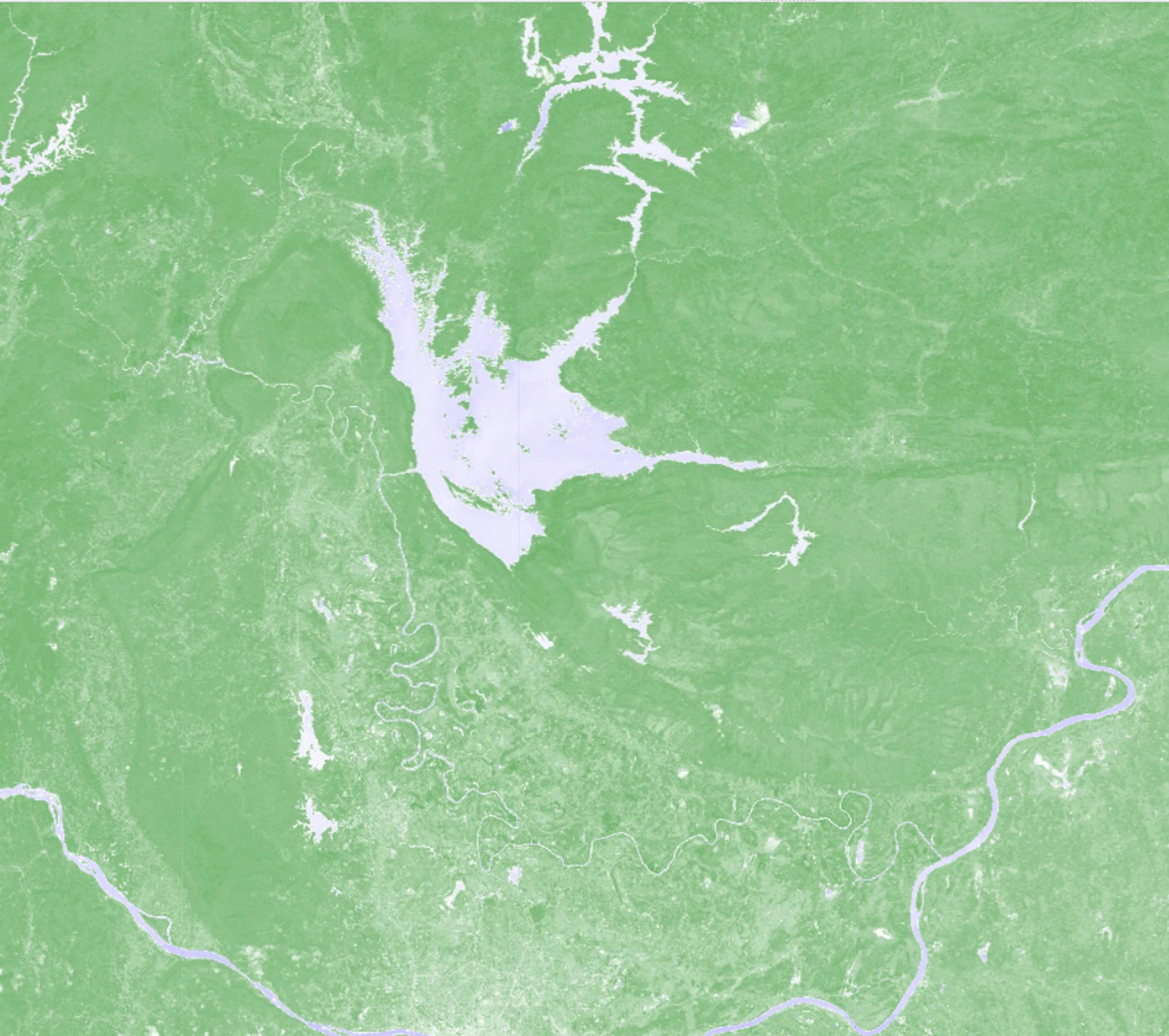
The NDWI is calculated using the green band (B3) and the near-infrared band (B8) of Sentinel-2:
NDWI = (Green - NIR) / (Green + NIR)
var ndwi = sentinel_Wet.median().normalizedDifference(['B3', 'B8']).rename('NDWI');
Map.addLayer(ndwi, {min:-1, max:1, palette:['brown','white','blue']}, 'NDWI');
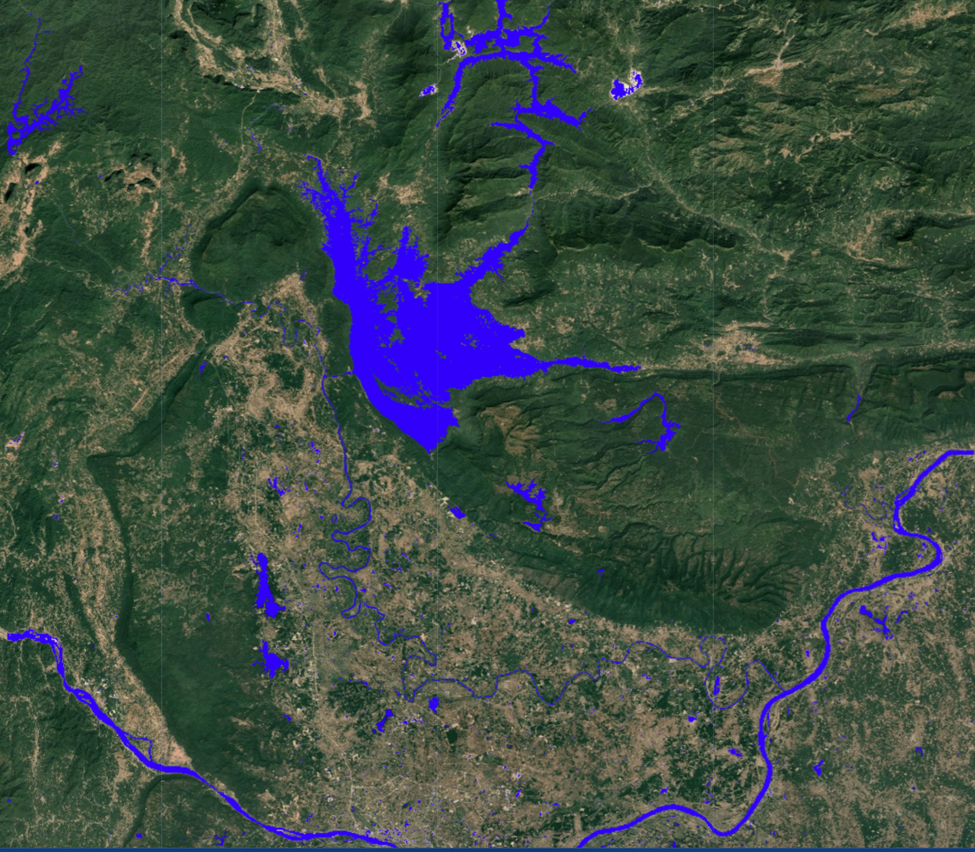
Step 3: NDWI Thresholding & Classification
The NDWI values in Sentinel-2 typically range from -1 to 1. Water bodies usually have higher values, while vegetation and built-up areas are negative.
- Clear deep water: usually > 0.2 – 0.3
- Turbid or shallow water: 0.0 – 0.2
- Wet soil or vegetation: can overlap near 0.0
-0.1 was applied after testing multiple thresholds.
This value captured water surfaces effectively in the study area.
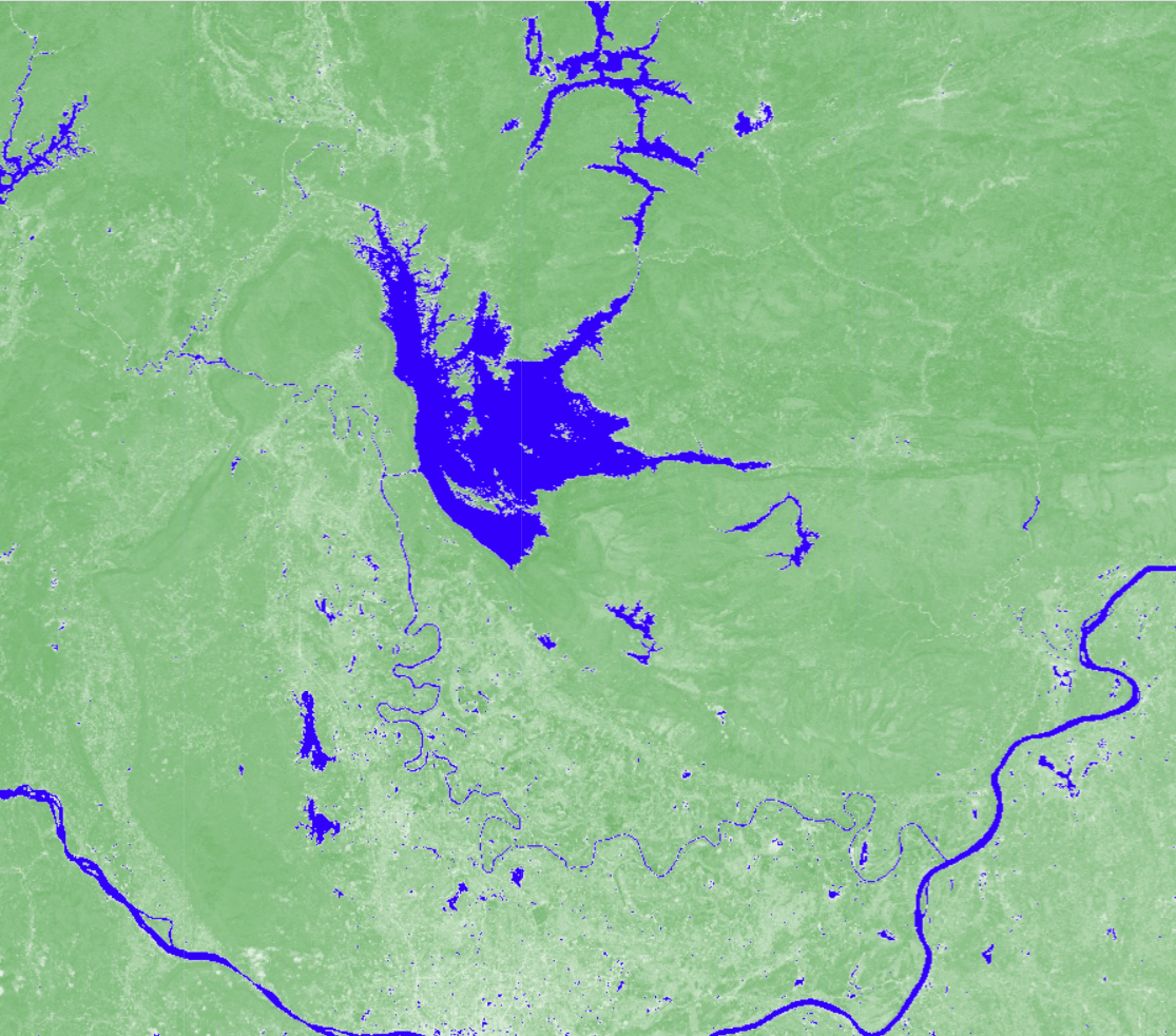
var water = ndwi.gt(-0.1);
Map.addLayer(water.updateMask(water), {palette:['blue']}, 'Water Mask');
Step 4: Water Surface Vectorization
The binary raster water mask was converted into polygons using reduceToVectors. This makes
the results more versatile for GIS tasks such as area calculation or overlay with boundaries.
// Convert water mask raster to vector polygons
var vectors_wet = water.addBands(water).reduceToVectors({
  geometry: roi,
  scale: 12,
  geometryType: 'polygon',
  eightConnected: false,
  labelProperty: 'Wet zone',
  reducer: ee.Reducer.mean()
});
Map.addLayer(vectors_wet, {color: 'cyan'}, 'Water Vectors');
Conclusion
This workflow demonstrates how NDWI can be applied for water surface mapping in Google Earth Engine. The process involves:
- Loading Sentinel-2 data
- Computing NDWI
- Threshold-based water classification
- Vectorization for GIS applications
The resulting vectors can be exported and used in further spatial analysis, environmental monitoring, or hydrological studies.
⬅ Back to Portfolio