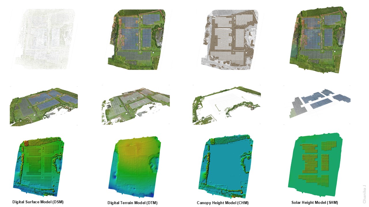
Drone-Based DEM Generation – High-resolution terrain models in Agisoft.
Process aerial data, create DSM & DEM, extract CHM, and develop precise solar height models. A powerful solution for topographic mapping and analysis!
- Digital Surface Model (DSM).
- Digital Elevation Model (DEM).
- Canopy Height Model (CHM).